Our 8th and final PA Section hike was planned for five days over Easter
weekend 4/17 to 4/22 of 2003. We had relatively short notice to plan since
I am between contracting jobs and we are building our house. We had to be
somewhat tentative about the dates since either work or house plans would take
precedence over a 5 day hike. Since it was raining on Thursday the 17th,
we decided to wait and go Friday morning.
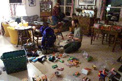
This hike started with the usual pandemonium packing the night before when we
should have actually already been on the trail in the tent if the original plan
was happening.
As something of a comic relief episode, it was raining worse when we started
this hike than it was when we cancelled the last hike early due to the rain!
Go Figure!
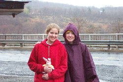
We left April 18th, 2003 on Good Friday about 12:30pm. Mommom
accompanied us as she did on our first hike and gave us each little bunnies and
pins to attach them to our packs. She smiled wearing a pink
plastic grocery bag as a rain hat and looked with one eye through the little
plastic handle hole. She was a sight to hike away from!
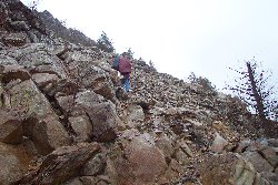
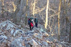
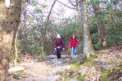
We began the rather steep ascent up the East side of Lehigh Gap on Blue Mountain
in the rain. In just a few minutes we were high above our drop-off point
at the far end of the Lehigh River Bridge.
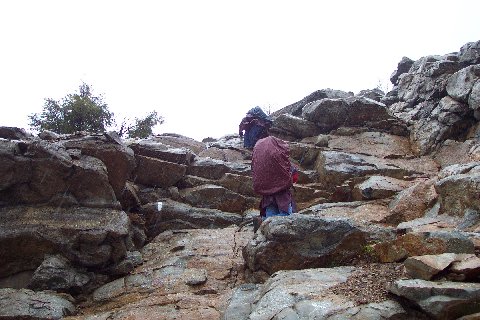
The climb was somewhat treacherous at some points and the treachery was
compounded by the reasonably heavy rain at the time. Here is a point on
the left where climbing required finding hand and foot holds and pulling
yourself and your pack up over the wet rocks. The girls did admirably with packs
averaging about 40+ pounds.
We finally got to the top after a more than 1000 foot vertical ascent. We
stopped to rest at a small stick and stone Teepee. Next to it were the
initials "U S M C" presumably referring to the US Marine Corps that were
performing with all our military an amazing deliverance of the Iraqi people.
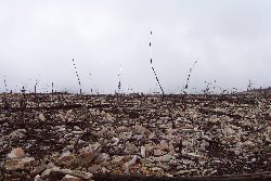
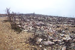
As we had been warned, the next several miles through a former Zinc Plant's
Superfund Cleanup Site was bleak. It was made bleaker by the fact that
last August, what little vegetation had grown in the area, was burned off by a
devastating forest fire.
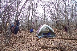
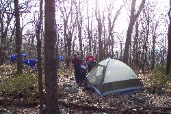
Our first night was spent at the 10 mile point of this hike near a spring at the
intersection of the AT and Delp's trail. Since it was occasionally
sprinkling, we used the tent's rain fly for only the second or third time ever.
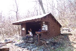
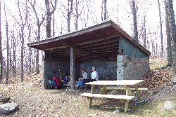
In the middle of the next day, we passed the Leroy Smith shelter. We
stopped in for a rest, snack and sock drying break and filled our water
containers at an amazingly fast flowing spring just down the mountain a hundred
yards or so.
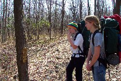
The next day we hiked...duhh. We found a 1/4 inch plate steel sign (right
photo) painted rusty yellow attached to a tree with an inscription made of
heavy welding marks that said: "Lost? Pen Argy!" Well...that helped.
If we weren't lost before, we were now. The next day I noticed a town on
the map named, Pen Argyl. Apparently someone was trying to help any
potentially lost hikers get their bearings. Unfortunately, those three
words with an unusually strange town name and the final "L" not quite fitting
all the way on the sign and looking like an exclamation mark, didn't really
help.
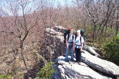
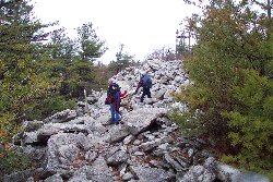
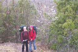
The trail follows along the crest of several beautiful rock outcroppings.
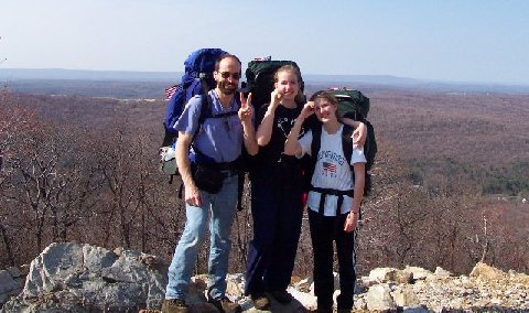
I calculated that this day would be the day we would cross the 200 mile mark in
our hike. We were all pumped up and took this celebratory "200" photo.
Later I was to discover that it was actually taken at the 208 mile mark.
But that didn't dampen our excitement at our accomplishment. Better to
overshoot than find out we had miles to go yet till we reached that mark.
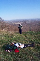
Heather wasn't feeling too well later in the day, so I shot her. Erica
couldn't watch so she went and looked over the valley while I took care of
Heather.
Since I now have a permit to carry my handgun legally, it is easier to help sick
hikers on their way.

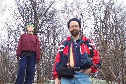
Since the girls were at times having trouble picking me out of the crowd of
other adult male hikers on the trail, I decided to identify myself with unique
and distinctive head gear. I created a fashionable sun bonnet from a
bandana and they no longer had trouble finding me when they needed me. I
think Martha Stewart would be envious.
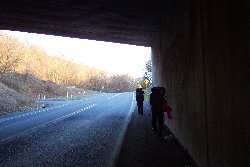
We descended into Wind Gap and crossed under Route 33 and then ascended
Kittatinny Mountain. That Saturday night, the 19th of April, we camped
just past the rim of the mountain.
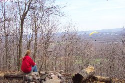
On Sunday afternoon, we arrived at the Kirkridge Shelter. Here we filled
out water containers at an outside spigot provided for hikers at a nearby
spiritual retreat center. Heather was relaxing at the edge of the lookout
and noticed several hang gliders sailing along the updraft of the wind along the
ridge.
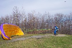
As we continued our hike, it wasn't long till we found the site the hang gliders
were launching from. We waited for quite a while, but none of them were
able to launch while we waited because the breeze was too strong. The hang
gliders we saw were mostly banana shaped parachute types where the "pilot" would
just stand with his back to the wind and pull on the top set of cables.
The glider would fill with air and lift the flyer off the ground and hopefully
let him sail away before crashing into the trees just a few yards down wind.
The flyer in the picture above almost made it, but his glider flipped up, spun
around, tangled, and fell in a heap seconds after this shot was taken.
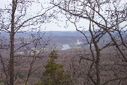
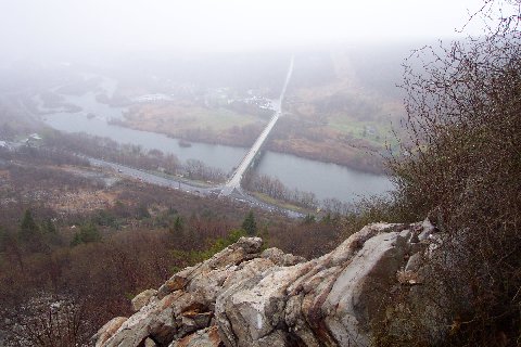
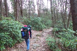
After leaving the hang gliders, we hiked another 6 or 7 miles and caught our
first glimpse of the Delaware River and New Jersey beyond. 3 1/2 Years and
225 miles ago we left Maryland and here we finally could see the end of the
trail! We were so close to completion, we called Cheryl to come pick us up
a day early and decided to finish the trail on that same day.
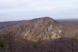
When we got to the edge of the gap overlooking the Delaware River, we could see
the "Crooked Mountain" (Heather's name for it) that is the continuation of
Kittatiny mountain and the AT in New Jersey.
The last 4 miles of the hike were through the Delaware Water Gap National
Recreation Area.
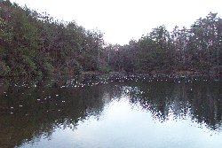
There were beautiful Hemlock forests, streams and ponds.
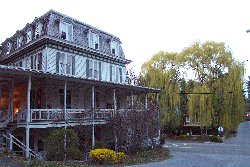
We waited just outside an historic Inn at the entrance to the Delaware Water Gap
Recreation Area. We were picked up at about 8:30 pm Easter Sunday
4/20/2003, therewith completing our hike of the Pennsylvania Section of the
Appalachian Trail! Yippee!!!